Home Travel Guide Photography Tips Travelogues Contact Us

Saturday, February 28, 2015

8 High Octane Himalayan Treks That Will Tickle Your Adventure Buds

By With No comments:
8 High Octane Himalayan Treks That Will Tickle Your Adventure Buds

1. Panpatia Pass 

Image Courtesy: www.photos.outlookindia.com

As per the legends, it is beleived that a priest used this route in search of the shortest route between Badrinath and Kedarnath shrines. He offered prayers at both these shrines in the same. To verify and follow the legend great explorers Eric Shipton and Bill Tilman made the crossing of the valleys from Badrinath to Kedarnath in 1934. They barely survived.


2. Kalindi Khal 

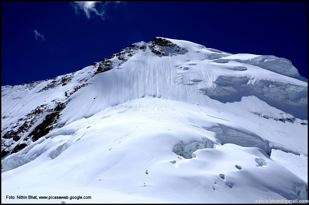
Image Courtesy: www.himalaya-info.org

Kalindikhal Trek is an extremely challenging expedition-style traverse of the Kalindikhal Pass (5967m) in spectacular Garhwal Himalayas. The route involves a trek over rough glaciers, rocky screens and crevassed snowfields. At times we need to roped up and require the use of ice axes and crampons. Kalindi khal trek takes you half way round Garhwal from the Bhagirathi Valley to the Alaknanda Valley. Although prior climbing experience is not required, this trip is one of our most demanding treks suited to only those who want to join a reconnaissance style expedition.


3. Auden’s Col

Image Courtesy: http://4.bp.blogspot.com

Auden’s Col is a high altitude mountain pass connecting Rudugaira valley and Bhilangna valley. It is situated at 5490m elevation and connects the ridge coming from Gangotri III (6580m) peak on the north-west and the ridge coming from Jogin I (6465m) on the east, and also binds a glacier coming from Jogin I on the north side of Rudugaira valley, and deadly Khatling glacier on the south side of Bhilangna valley.


4. Stok Kangri

Image Courtesy: http://www.footootjes.nl

Stok Kangri (elevation 6,153 m (20,182 feet) is the highest mountain in the Stok Range of the Himalayas in the Ladakh region of northwest India. The peak is located in Hemis National Park, 12 km southwest of the trailhead at 3,610 m (11,845 feet) in the village of Stok and around 15  km southwest of the Ladakhi capital of Leh. Despite its altitude, Stok Kangri is a popular peak and is often climbed as an initial non-technical foray into high altitude mountaineering. However, Stok Kangri is very often underestimated for its difficulty level.


5. Lamkhaga Pass

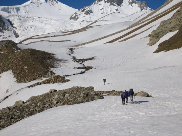
Image Courtesy: www.indiamike.com

The Lamkhaga Pass connects north eastern Garhwal and Himachal Pradesh and is surrounded by an enticing landscape of snow, mountains and air of mystery. The treacherous trek involves a steep ascent to 5200 feet, precarious glaciers and stream crossings, thin air and uneven terrain. It is rated as one of the most dangerous trails amongst the various mountain treks in India and even Indians require special permission to go on the trek.


6. Pin Parvati Pass

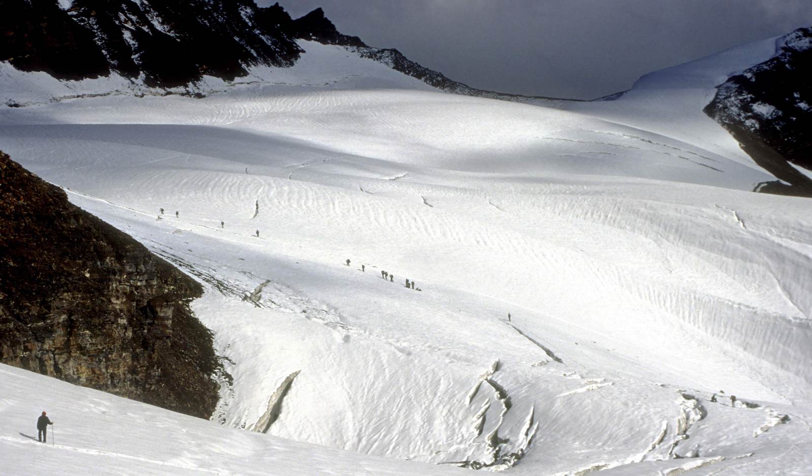
Image Courtesy: www.greathimalayannationalpark.com

The trek over Pin Parvati Pass is one of the most challenging and adventurous trek that requires lot of physical stamina and mental strength. Ascent to more than 4800 metres, difficult gradient, a steep incline, rough terrain, snow and glaciers and ill-defined trails, are some of the challenge that trekkers confront.


7. Khangchendzonga Range Trek

Image Courtesy: www.dooarsecoviillege.files.wordpress.com

The Khangchendzonga Range Trek Sikkim is a haven for trekking fanatics, and amongst the various popular treks, the one that remains the most popular is the Khangchendzonga Range Trek, which passes through the foot of Mt. Kangchenjunga, the third highest peak in the world. You get the most astounding view of the Himalayas from Dzongri and Gochila. Most of the treks start at Yoksum or Bagdogra and end at Goecha La, and on the way, you can spot glaciers, yaks and three different tribes that are peculiar to this region –  Lephcas, Nepalese and Bhutias. The trek assures great flora fauna and alpine camping experience as well.


8. Rupin Pass

Image Courtesy: indiahikes.com - Sreejith

Rupin Pass is a high altitude pass across the Himalaya mountain range in state of Himachal Pradesh, India. It lies on a traditional shepherd and hiking route which starts from Dhaula in Uttarakhand and ends in Sangla in Himachal Pradesh. The path itself is located across mostly uninhabited areas in the Himalayan ranges at an elevation of 15,250 ft (4,650M) above sea level.

Read More

Friday, January 23, 2015

Glamor, Color, Landscape! 6 Exquisite Alpine Lakes In India

By With No comments:
Glamor, Color, Landscape! 6 Exquisite Alpine Lakes In India

1. Gurudongmar Lake – Sikkim

0000
Gurudongmar lake provides one of the source streams of the Teesta River. The source of Teesta, the Tso Lhamo Lake, lies some 5 km (3.1 mi) to the east. One can seek permission from the army to go to the Gurudongmar Lake but civilians  are not permitted to go up to Tso Lhsmo Lake. The  pristine blue glitter of the lake backed by huge snow-clad mountains is second to none.

At an attitude of 5,210 m, Gurudongmar is one of the highest lakes in the world. It lies in the North Sikkim and the terrain is pretty harsh. The lake remains frozen during the winter season and the temperature in winter drops to around minus thirty degrees (-30°C).


2. Chandrataal – Himachal

_DSC0401_1
Chandrataal or the Moon Lake is an Alpine lake situated at an altitude of about 4,300 m in the Spiti district of Himachal Pradesh. It is considered to be source of Chandra River and is part of the Samudra Tapu plateau.
 
The lake is accessible by two routes, one from Manali side via Rohtang Pass and other from the Spiti side via Kunzum pass. Both the passes are closed for vehicles in the winter months due to heavy snowfall and the lake remain accessible only on foot. The lake is surrounded by lush green meadows which serves as perfect camp sites and the rugged colors of the surrounding mountains adds to the thrill. The source of the lake seems to be underground because there is no visible source like a glacier feeding it.


3. Pangong Lake – Ladakh

September
At an altitude of 4,350 m and only about 160kms from Leh lies the Pangong Lake which can be called as the most glamorous lakes of all. It lies in the must visit list of almost every traveler. It is 134 kms long and approximately 60% of the lake lies in Tibet. It is long enough to be clearly seen in the map, crossing from India to Tibet.
Despite being saline in nature, the lake completely freezes in winter. The glamorous blue color of the lake can even be seen when it is frozen. The dramatic landscapes attracts thousands of bikers per year, even during extreme winters.
Pangong lies very near to the Line of Actual Control but from 2014, inner line permit is not required for Indian Nationals to visit the lake.


4. Tsomoriri Lake – Ladakh

_DSC0457
Another pristine Alpine lake in the Ladakh region situated at an altitude of 4,595 m. Located near the 400 year old Korzok Monastery, it is the largest lake in the Trans-Himalayan region. The journey to Tsomoriri is mainly along the Indus river which takes you to the Changthang plateau. The enthralling landscapes tops the list of every traveler.
The lake is located to the southeast of Leh at a distance of about 240 kms and the road is in good condition for most of the part, with only few bad patches. It can also be reached from Pangong lake directly via Chushul.
During winters, the lake freezes completely and so does the Indus river along the journey. Temperature dips to as low as minus twenty five degrees (-25°C)


5. Suraj Taal - Himachal

aMl (8)
Suraj Taal is located at the base of Baralacha pass in Lahaul Valley. At an altitude of 4,883 m, it is the third highest lake in India. In a location amid natural splendor, it is a lake that cannot be missed by any adventurer or traveler.
The lake can be reached from Manali side via the Rohtang pass and also from the Ladakh side crossing many passes like the Taglang La and Baralacha pass. There is also a trek route connecting Suraj Taal to Chandrataal. The lake remains inaccessible during winters because all the passes between Manali-Leh highway are closed for vehicular traffic due to heavy snowfall.


6. Tsongmo Lake

Sikkim_Pic-3_Tsomgo-Lake
Image courtesy: http://envfor.nic.in/
   
Tsomgo means source of the water in Bhutia language. Also called as Changu Lake, it is associated with many myths and is of special significance for the Sikkimese. According to the legends, the monks living there used to predict the future based on color of the lake.
At an elevation of 3,780 m, the lake is situated on the eastern side of Sikkim, around 40 kms from the Gangtok city. Between the months of May and August, you can trace a variety of flowers including rhododendrons, primulas and blue & yellow poppies.

The lake remains frozen throughout the winter up to April end.


Read More
Home Travel Guide Travelogues Contact Us
Copyright © 2014 Focal Ninja | All Rights Reserved. Design By Blogger Templates